Engineering Geophysics

Engineering geophysics involves advanced subsurface investigation methods used for civil engineering, infrastructure, groundwater, and construction projects.

CG Geo Exploration provides reliable geophysical survey solutions for foundation studies, cavity detection, tunnel route investigations, bedrock profiling, and underground condition assessment.

Using modern digital acquisition systems and advanced interpretation techniques, we help support hydropower, thermal power, bridges, dams, highways, tunnels, and heavy structural projects with accurate geological and geophysical analysis.


Geophysical Data Processing

Accurate Interpretation

Advanced data analysis and interpretation for reliable subsurface investigation results.

Faster Reporting

Real-time processing and efficient reporting to support faster project decisions.

Modern Software

Processing geophysical survey data using advanced industry-standard technologies and tools.

Expert Analysis

Experienced geologists and geophysicists delivering high-quality technical interpretation services.


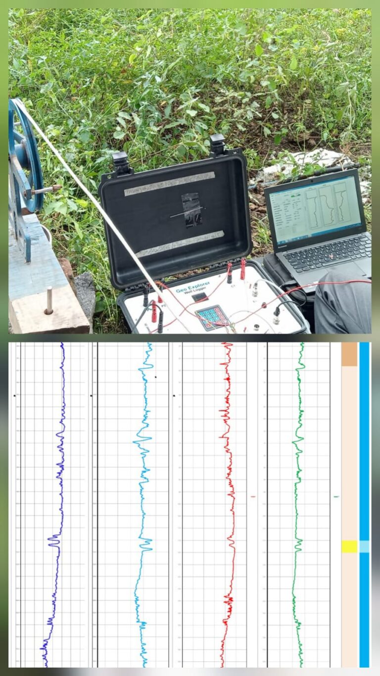
Well Logging

We provide well logging services to evaluate subsurface geological and hydrogeological conditions within boreholes and water wells. Our investigations involve recording electrical, geological, and physical properties using advanced logging tools to identify aquifers, fractures, lithology variations, seepage zones, and groundwater-bearing formations. We implement methods such as SP logging, resistivity logging, gamma logging, caliper logging, and temperature logging for groundwater exploration, borewell assessment, tunnel investigations, dam safety studies, and geotechnical projects. These surveys help improve drilling accuracy, aquifer characterization, and engineering decision-making through detailed subsurface interpretation.

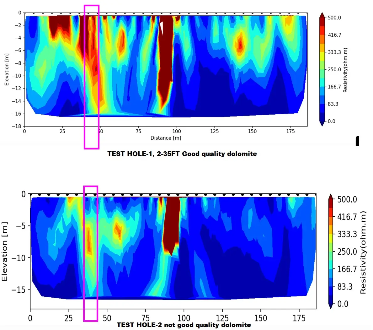
Electrical Resistivity Tomography (ERT)

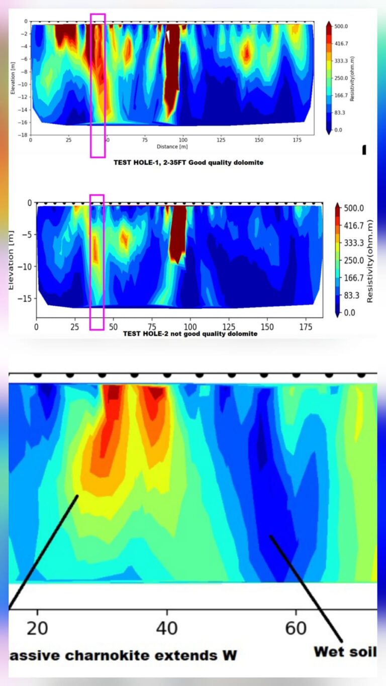
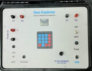
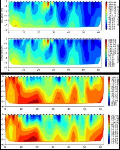
We conduct Electrical Resistivity Tomography (ERT) surveys to obtain detailed subsurface resistivity imaging for groundwater, geological, and geotechnical investigations. The method is implemented by injecting electrical current into the ground through multiple electrodes and measuring resistivity variations to identify aquifers, fractures, weathered zones, seepage paths, cavities, and weak rock formations. Our ERT surveys provide high-resolution subsurface profiles widely used in groundwater exploration, dam and tunnel investigations, mining studies, and environmental assessments.


Pump Test Using Water Level Indicator

A pump test is a hydrogeological investigation conducted to evaluate aquifer characteristics, borewell yield, groundwater potential, transmissivity, storativity, and sustainable pumping capacity. The test helps determine the performance and long-term viability of groundwater extraction systems.

The investigation involves controlled pumping and continuous groundwater level monitoring using electronic water level indicators to analyze aquifer performance and groundwater behavior.

Applications

  • Groundwater exploration
  • Borewell yield assessment
  • Mining hydrogeology
  • Infrastructure and tunnel projects
  • Environmental groundwater studies
  • Irrigation well evaluation

Equipment Used

  • Submersible pump
  • Water level indicator
  • Discharge measurement system
  • Power supply unit

Hydrogeological Parameters Evaluated

  • Drawdown (s)
  • Transmissivity (T)
  • Hydraulic Conductivity (K)
  • Storativity (S)
  • Specific Capacity

Common interpretation methods include:

  • Theis Method
  • Cooper–Jacob Method

Pump Test Procedure

1. Static Water Level Measurement

Before pumping begins, the initial groundwater level is measured using a water level indicator.

2. Constant Rate Pumping

The pump is operated at a constant discharge rate while flow measurements are recorded periodically.

3. Drawdown Monitoring

Groundwater level changes are recorded using the water level indicator at regular intervals such as:

  • 1 minute
  • 2 minutes
  • 5 minutes
  • 10 minutes
  • 15 minutes
  • 30 minutes
  • 1 hour and beyond
4. Recovery Test

After pumping stops, groundwater level recovery is monitored over time to evaluate aquifer recharge characteristics.


Self Potential (SP) Survey

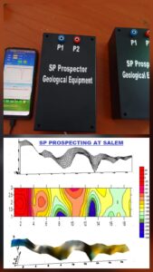
We conduct Self Potential (SP) surveys as a passive geophysical method to detect natural electrical potential variations associated with groundwater movement in the subsurface. The method is implemented using non-polarizable electrodes and high-sensitivity measurements to identify fractures, seepage paths, weathered zones, and groundwater flow channels. Our SP investigations are widely used for groundwater exploration, dam seepage studies, tunnel investigations, and fracture zone mapping, often integrated with VES and ERT surveys for improved subsurface interpretation and accurate borewell targeting.

Vertical Electrical Sounding (VES) Survey

We conduct Vertical Electrical Sounding (VES) surveys using the Schlumberger electrode configuration to investigate subsurface resistivity variations. The method is implemented by injecting electrical current into the ground and measuring the resulting potential difference to identify aquifers, weathered zones, fractures, and hard rock formations. Our surveys provide reliable data for groundwater exploration, borewell siting, aquifer depth estimation, and geological investigations through accurate field measurements and interpretation.


ARCHAEOLOGICAL GEOPHYSICS

Non-invasive geophysical surveys for detecting buried structures, ancient remains, and subsurface archaeological features.

Learn More

We conduct advanced archaeological geophysical surveys to detect buried structures, ancient foundations, underground pathways, cultural remains, and subsurface features without excavation using modern non-invasive investigation techniques.

DAM SAFETY

Geophysical investigations for dam foundation studies, leakage detection, and structural safety assessment.

Learn More

Advanced geophysical surveys for dam safety and foundation investigations including seismic refraction, resistivity imaging, subsurface profiling, fracture detection, seepage analysis, leakage identification, and structural integrity assessment for hydropower and irrigation projects.

Graphic DesignMINING GEOPHYSICS

Geophysical investigations for mineral exploration, ore body mapping, and subsurface mining studies.

Learn More

Comprehensive geophysical surveys for mining and mineral exploration including magnetic surveys, electrical resistivity imaging, seismic methods, subsurface profiling, ore body delineation, underground cavity detection, and geological structure mapping for efficient mine planning and resource evaluation.


TUNNELING GEOPHYSICS

Geophysical investigations for tunnel alignment studies, subsurface profiling, and underground cavity detection.

Learn More

Advanced geophysical surveys for tunneling projects including seismic refraction, resistivity imaging, subsurface profiling, fracture zone identification, cavity detection, rock quality assessment, and tunnel route investigations for safe and efficient underground construction.

WATER RESOURCES GEOPHYSICS

Geophysical surveys for groundwater exploration, aquifer mapping, and subsurface water investigations.

Learn More

Comprehensive geophysical investigations for groundwater and water resource studies including electrical resistivity surveys, aquifer delineation, subsurface water detection, borewell site selection, groundwater potential assessment, and hydrogeological mapping for sustainable water resource management.

ENVIRONMENTAL GEOPHYSICS

Geophysical investigations for environmental assessment, contamination studies, and subsurface monitoring.

Learn More

Advanced environmental geophysical surveys for pollution assessment, landfill investigations, subsurface contamination mapping, soil characterization, groundwater monitoring, waste disposal studies, and environmental impact investigations using non-invasive geophysical techniques.


LIBS Element Detection Technology

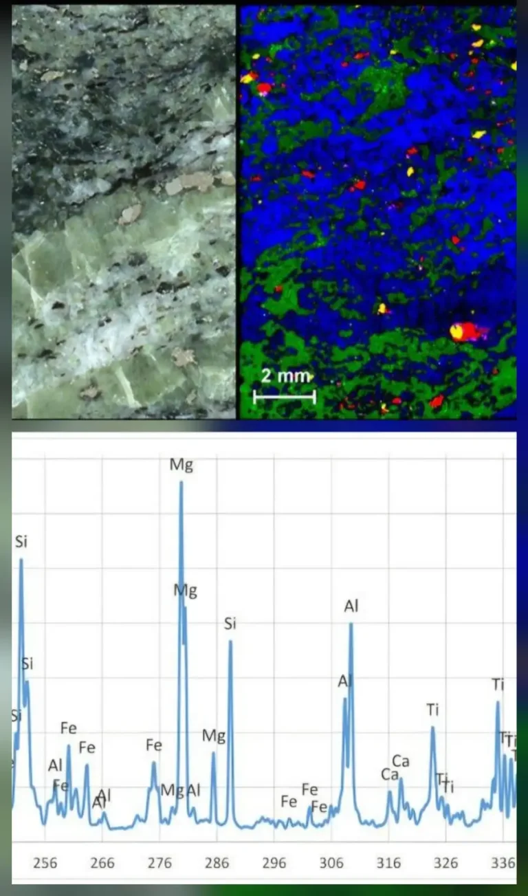
CG LIBS (Laser-Induced Breakdown Spectroscopy) is a rapid elemental analysis technology used for mineral identification and field-based exploration studies. The system uses high-energy laser pulses to generate plasma and identify elemental composition through spectral analysis.

LIBS technology supports rapid ore identification, mineral exploration, rare earth element detection, and real-time field analysis without sample preparation, making it highly effective for mining and geological investigations.

RESULTS DRIVEN SECTION SOLUTION

CG Geo Exploration focuses on delivering accurate subsurface data, reliable interpretation, and cost-effective exploration solutions through modern geophysical technologies and experienced field operations.

Our commitment to scientific precision and practical investigation helps clients achieve dependable project outcomes.

picture showing before and after LIBS technology

Our Team

Meet the experienced professionals behind CG Geo Exploration, delivering advanced geological, geophysical, and exploration solutions with technical expertise and field experience.

N. Sankar

Geo-Exploration Expert | Geologist | Geophysical Consultant Experienced geology and geo-exploration professional with over 25 years of expertise in mineral exploration, geological mapping, groundwater investigation, geophysical surveys, and mining consultancy.

R. Padakathu

Geologist | Geophysical Instrumentation Specialist Experienced geologist and geophysical survey specialist with expertise in oil & gas exploration, groundwater investigation, electrical well logging, mineral exploration, geotechnical investigations, and geophysical instrumentation development since 2007.


Trusted Geophysical Exploration Experts

CG Geo Exploration delivers advanced geophysical, geological, groundwater, and mineral exploration solutions using modern survey technologies and accurate subsurface investigation methods. Our experienced team provides reliable interpretation, field analysis, and cost-effective solutions for mining, infrastructure, environmental, and engineering projects.